Introducing Airspace+: catch-up TV for the skies
17 August 2016Any regular readers of the blog will have seen the data visualisation videos that we’ve produced over the past few years showing a day’s worth of aircraft in the skies over various places around the world.
We’ve found them to be a fantastic tool to help illustrate the skill and complexity that goes into air traffic management and we’ve been amazed and delighted at the reception they’ve received, attracting millions of views and interest all over the world. The videos have played on the world’s largest video wall in Singapore and we’ve even won an award – which was an unexpected surprise!
But by their very nature, the videos are confined to showing the traffic as it was on a single day in history. Some of our earliest visualisations are using data from 2014 and as such aren’t able to show the ebb and flow of daily traffic movements.
So with that in mind, and in honour of Skies Above Britain starting tonight on BBC2, we’ve been working with our friends at 422 South and FlightAware to come up with something new: Airspace+
Airspace+ uses aircraft positional data to create near real-time visualisations of the air traffic in our skies. It can do this for anywhere in the world, working incredibly quickly to crunch thousands of lines of data in seconds.


422 South uses a proprietary technology called Global Data Navigator (GDN). GDN continuously ingests a live stream of air traffic data for our choice of locations and time periods.
Once collected, a batch of data is automatically expressed as moving dots over a satellite image background with the correct level and direction of sunlight for the time of day.
The software uses a pre-programmed ‘camera’ to record the result, to render a short animated video, add a digital clock and music, and automatically feed it to the NATS website. The whole process, takes less than 30 minutes, and is constantly cycling.
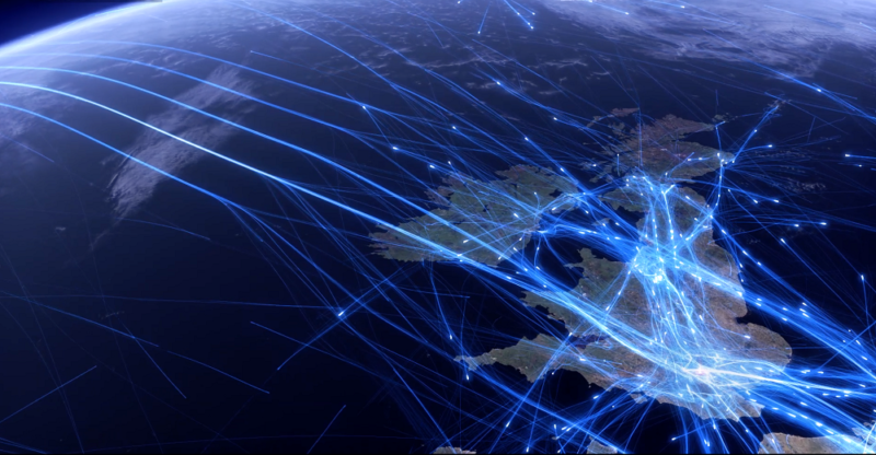
The results are beautifully cinematic visualisations of the previous 24 hours (or last two hours for South East England) of air traffic for locations around the UK and the rest of the world, updated every hour, on the hour.
UK 24 Hours – Between Tuesday 16 August 2016 11:00 and Wednesday 17 August 2016 11:00 from NATS on Vimeo.
Each video shows a single location, but eventually we hope to be able to include a level of interactivity, perhaps enabling you to choose the exact location or camera position, or even search for and then highlight specific flights so you can create and keep your own visualisation to go with your holiday snaps.
Take a look at the Airspace+ page and we’d love to know what you think. If you’ve got any ideas for features you’d like us to try and implement in the future leave a comment and let us know.
You may also be interested in...
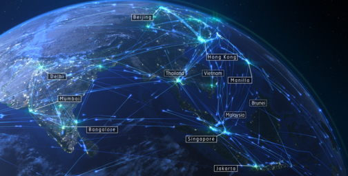
Asia Pacific 24
Read more
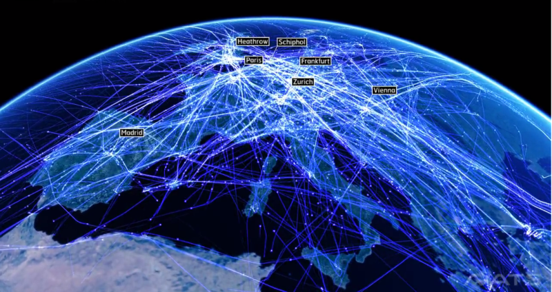
Europe 24 – an air traffic data visualisation
Read moreComments
Please respect our commenting policy and guidelines when posting on this website.
17.08.2016
13:37
Chris Lawrence
Any chance of a Scottish TMA feed?
17.08.2016
17:11
peter Hadjigeorgiou
Can you make one for the eastern mediterranean? Thank!